Alice's Tour Pictures for Boston Topographical History Course

Landmaking
Tours
Central Waterfront
Bulfinch Triangle
West End
Beacon Hill Flat
Back Bay & South End
Fens, Fenway & Bay State Rd.
South Cove
South Bay & South End
South Boston
Dorchester
East Boston
Charlestown
The West End
The West End was originally not a settled area, but a fringe one that supported industrial and institutional facilities. During the eighteenth century, ropewalks and a copper works occupied today's site of the Charles River Park. Early nineteenth century needs led to the first landmaking project at today's Martha Road/Amy Court to relocate the almshouse, which in turn was soon shifted within a few years to another developing area at the time: South Boston. Further landmaking extended Charles Street north of Cambridge Street into the West End, and the Charlesbank park was created in the 1880's. The 1930's saw the widening of the shore of Charlesbank. That shoreline was filled further into the river during the construction of Storrow Drive. Concurrent with the highway project, a major urban development project in the late 1950's razed buildings and streets and displaced many of the neighborhood's predominantly working-class population to create the "If you lived here, you'd be home now." building complexes of Charles River Park.
Other streets comprising this area are: Lomasney Way; North Anderson, Blossom, Fruit, North Grove, and Parkman Streets. Major landmarks and buildings in this area and its vicinity include the Massachusetts General Hospital's Bulfinch Pavilion, the Charles River Dam, the Charles Street Jail, Charlesbank park and the Museum of Science.
Charles River Dam
I am the sole person responsible for the content of this photo gallery site. Please contact me if I have made any mistakes in citing a photo's location or detail.
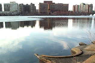
Cambridge across the
Charles River
In this view towards Cambridge, the remains of an oil boom lines the Boston
shore near the Charles River Dam.
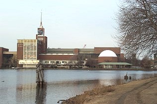
Science Museum complex
Part of the planning of the Charles River Dam included a parkland area along
its length on the basin (upriver) side. Today, the Museum of Science's
buildings stand on that parkland.
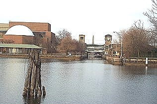
Charles River Lock
The lock allows boat traffic to enter the river from Boston Harbor.
From the land side, the lock is located just past Leverett Circle on
the way to the Green Line's Lechmere Station and to the Msgr. O'Brien
Highway. The Hayden Planetarium dome appears on the left.

Shore at Charlesbank
A sloping shore was installed on the fill added to Charlesbank in the 1930's
and 1950's because the earlier seawall caused heavy chop that prevented the
use of small boats and sculls on the water of the dammed Charles River.
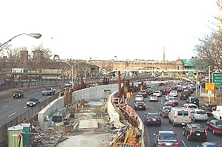
Charles River Dam and
Storrow Drive
This view was taken from the pedestrian overpass across Storrow Drive at
Blossom Street and looks towards the Charles River Dam. The river
shoreline in the 1860's and 1870's ran roughly along the center of this
view.
Charles River Park
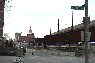
Site of Almshouse
Formerly located in the Park Street area of the Common, the Almshouse
relocated to this site on new made land and later had a wharf extended
behind from it where the elevated Green Line tracks now run. Water stood
beyond the area of this view that includes the Science Museum in the
distance.
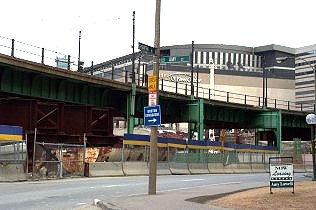
Northeast View from
Martha Road/Amy Court
Looking northeastward, the FleetCenter also stands in an area that was
formerly dominated by water.

East view from within
Charles River Park
Looking eastward, the new Suffolk County Jail on Nashua Street can be seen
from Charles River Park. This facility replaced the Charles Street Jail
built in the mid-19th century.
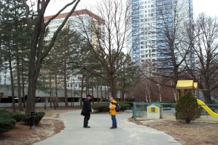
Inside Charles River
Park
Classmates provide a scale perspective of Charles River Park: a number of
city blocks similar in length to this pathway and lined with tenement
buildings were destroyed to create this "community" complex of high-rise
apartment buildings and winding park paths.
Charles Street
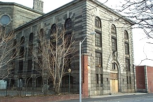
Charles Street Jail
The jail had a cruciform shape which is now truncated by the Massachusetts
General Hospital building under construction. The remainder of this facility
will be converted into a hotel.
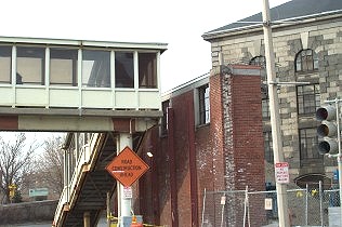
Charles Street Jail
Wall
The jail had a high brick wall surrounding it to create a courtyard. Under
renovation now, most of the wall has been taken down except for this segment
near the stair entry to the Red Line's Charles/MGH station.
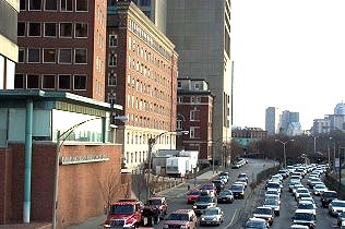
View of Charles Street
near Blossom Street
The three northbound lanes of Storrow Drive run parallel to Charles Street
and the buildings of the Massachusetts General Hospital are on the left.
In the 1860's and 1870's the Charles River shoreline ran along the right
edge of this shot in the middle of the southbound lanes.
Lomasney Way
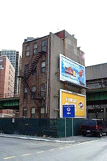
Rear View of the Last
West End Tenement
This building is an island among new buildings within the old neighborhood
known as the West End, before the creation of Charles River Park. Located on
Lomasney Way (the Green Line's elevated track runs along behind it), it is
between Martha Road and Cotting Street. The FleetCenter and its north
garage entrance are located to the left of this camera position.
North Anderson Street

Bulfinch Pavilion
Designed by Charles Bulfinch, this building is the original hospital
building for the Massachusetts General Hospital. It features the ether
dome, located just behind and above the pediment facade, where the first
surgery using anesthesia was performed.
North Grove Street

1891 Resident
Physician's House
This building, originally sited at Allen and Blossom Streets, was moved to
Blossom Street in 1949 before it was moved again to this location in 1983.
The early 19th century Parkman Market stood opposite this house behind the
camera's position.
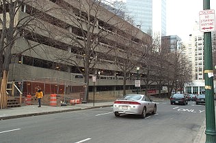
MGH Garage on Grove
Street
Adjacent to the Resident Physician's House, this garage lines up along the
original 1799 abutment and shoreline of the West End. Part of
MGH's George R. White Memorial Building can be seen on the right.
© 2004 Alice Kane