Alice's Tour Pictures for Boston Topographical History Course

Landmaking
Tours
Central Waterfront
Bulfinch Triangle
West End
Beacon Hill Flat
Back Bay & South End
Fens, Fenway & Bay State Rd.
South Cove
South Bay & South End
South Boston
Dorchester
East Boston
Charlestown
Beacon Hill Flat
Formed in 1794, the Mt. Vernon Proprietors, initially Harrison Gray Otis, Jonathan Mason, Charles Bulfinch, Joseph Woodward and William Scollay, cut down Mt. Vernon hill to create the Flat in the early part of the nineteenth century. Before its levelling and development, Mt. Vernon hill featured Boston town's red light district on its northern slope and was locally known as Mt. Whoredom. The development of this area came into question because several of the proprietors were also selectmen or legislators who may have had insider knowledge of the new site of today's State House on Beacon Hill. The first railway in the U.S. was laid from today's Louisburg Square to Charles Street to facilitate this landmaking project.
Other streets comprising this area are: Beaver and Otis Places; Embankment Road (now David Mugar Way); Beaver, Brimmer, Byron, Chestnut, Lime, Mt. Vernon, Phillips, River, Revere, and West Cedar Streets. Major landmarks and buildings in this area and its vicinity include Charles St. Meetinghouse, the "Sunflower" House, the Church of the Advent, the Hatch Shell, the Union Club Boat House and Storrow Drive.
Beaver Place/Street
I am the sole person responsible for the content of this photo gallery site. Please contact me if I have made any mistakes in citing a photo's location or detail.
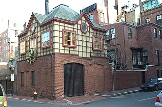
Deutsch House on
Beaver Street at Beaver Place
This building was renovated in 1983 by Graham Gund Associates, which added
the second story on top of the tiny house that existed on the site behind
the garden wall.
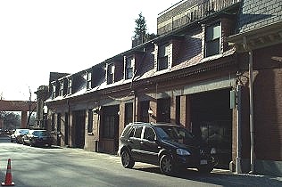
Beaver Place
The buildings along Beaver Place were stables for the elite of Beacon Hill.
The uniform height of these converted residences gives the viewer an idea of
their former function.
Charles Street
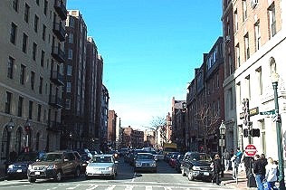
Corner of Charles and
Beacon Streets
A view of Charles Street from the intersection of Beacon Street. The
westernmost shoreline of the original peninsula was to the right of today's
Charles Street.
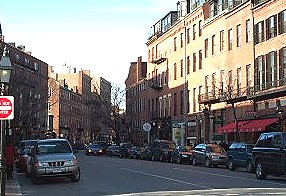
Charles St. Bend
Originally to be laid straight to the West Boston, now Longfellow, Bridge,
the street bends right to meet with Cambridge St. The street alignment
was shifted closer to the existing shoreline to save money on the
landmaking.
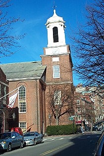
Charles Street
Meetinghouse
Designed by Asher Benjamin for the Third Baptist Church in 1806 or 1807,
this building features a 8-sided cupola and stood at the shoreline of the
Charles River at the time of its completion. Today, it houses office
and commercial spaces.
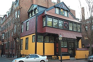
The Sunflower House
Located near the Charles St. Meeting House at 130 Mt. Vernon Street, this
house was originally built in 1840 and was renovated by Charles Luce in 1878
in the Queen Anne/Tudor style that one sees today.
Embankment Road
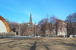
Embankment Road from
Hatch Shell
This picture views the line of Embankment Road, now David Mugar Way, on the
other side of Storrow Drive. The steeple of the Church of the Advent on
Brimmer Street can be seen in the center.
The Esplanade
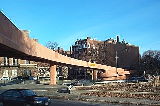
Arthur Fiedler
Footbridge
A view of the footbridge from the Esplanade side of Storrow Drive. In the
center of this picture, Beaver Place opens to the footbridge entrance of the
drive.
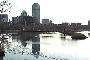
Esplanade Lagoon
The lagoon islands were first created in the 1930's as part of the widening
of the Esplanade. Hydraulic dredges were used to suck mud up from the bottom
of the river and piped to the islands location.
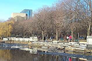
Commissioners Landing
Completed as part of the widening of the Esplanade in the 1930's, this site
is one of the 10 most endangered historic sites in Massachusetts.
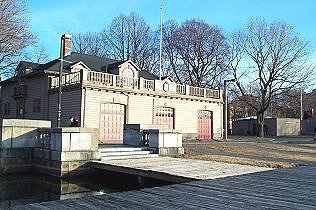
Union Club Boat House
Located a small distance behind the Hatch Shell, the boat house is adjacent
to Commissioners Landing.
Louisburg Square
Louisburg Square
This view looks at Louisburg Square from Mt. Vernon Street. Pinckney
Street crosses the square at the other end.
Pinckney Street from
Louisburg Square
On the other side, this view looks down Pinckney Street from Louisburg
Square (and Sen. Kerry's Secret Service detail) to Charles Street.
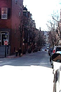
Phillips Street
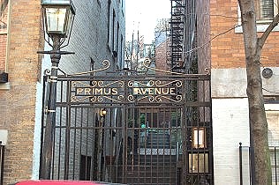
Primus Avenue
Originally called Wilberforce Place in 1843, Charles Blackall designed this
terraced lane featuring duplex apartment buildings.
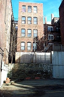
View 1/Cul-de-sac off
Phillips Street
An illustration of building on a hill: this wall shows the layers of support
for buildings further up on Phillips Street which runs along the building on
the left.
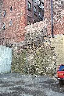
View 2/Cul-de-sac off
Phillips Street
This view is to the right of the one above and has a portion of a vehicle to
give a height perspective. The garden wall near the picture's center
is on one of the cul-de-sacs off Revere Street.
© 2004 Alice Kane