Alice's Tour Pictures for Boston Topographical History Course

Landmaking
Tours
Central Waterfront
Bulfinch Triangle
West End
Beacon Hill Flat
Back Bay & South End
Fens, Fenway & Bay State Rd.
South Cove
South Bay & South End
South Boston
Dorchester
East Boston
Charlestown
The Bulfinch Triangle
Charles Bulfinch was a member of the Selectmen's committee that designed the street layout of this landmaking project and drew the plan, hence the name Bulfinch Triangle. This area is shaped as a southeastward pointing triangle with today's Causeway Street as the straight side at the top and Merrimac and North Washington Streets meeting to form a point at the Haymarket Parking Garage. Canal Street runs down the center of the triangle and was originally a canal carrying vessels northward as part of the Middlesex Canal.
Other streets comprising this area are: Lancaster, Portland, Friend, Haverhill, Medford, Traverse, and Market Streets. Major landmarks and buildings in this area and its vicinity include the Fleet Center, the Tip O'Neill Federal Building, the Edward Brooke Courthouse, Paddy Burke's Pub, and the Leonard Zakim Bridge.
Causeway Street
I am the sole person responsible for the content of this photo gallery site. Please contact me if I have made any mistakes in citing a photo's location or detail.

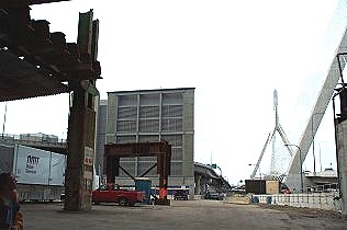
View Behind Fleet Center
A view of the former Nashua St. off ramp overhead and the Leonard Zakim
Bridge.

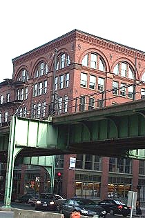
Corner of Causeway and
Friend Streets
A view of building at corner of Causeway and Friend Streets. The elevated
Green Line tracks runs along over Causeway Street and this intersection.
Merrimac Street

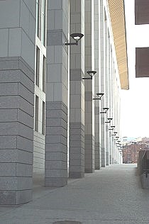
Back of Brooke Courthouse
A view of the colonnade.

Paddy Burke's Pub
The pub occupies three floors of this Second Empire-styled building.
The building stands as an island where the ends of Merrimac, Traverse and
Portland Streets meet.

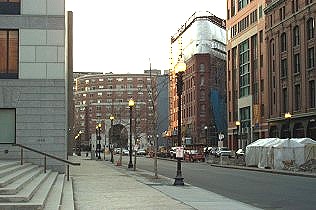
View to Staniford Street
and One West End Place
This view looks along Merrimac Street towards One West End Place. The steps
on the left of those of the Edward Brooke Courthouse which was completed in
1998.
© 2004 Alice Kane