Alice's Tour Pictures for Boston Topographical History Course

Landmaking
Tours
Central Waterfront
Bulfinch Triangle
West End
Beacon Hill Flat
Back Bay & South End
Fens, Fenway & Bay State Rd.
South Cove
South Bay & South End
South Boston
Dorchester
East Boston
Charlestown
Central Waterfront
The Central Waterfront was the heart of Boston in its first two hundred years. Settlers and goods landed at the wharves there. A remnant of the 17th and 18th centuries can be found in Creek Square and its adjacent streets, located behind the Millennium Bostonian Hotel and the Union Oyster House. The construction of the Central Artery in the 1950's literally cut some waterfront buildings in two, while also razing whole street blocks.
Streets and wharves in this area include: Atlantic Avenue; Batterymarch, Blackstone, Broad, Franklin, High, India, Milk, North, Oliver, and Water Streets; and India, Central, Long, T, and Commercial Wharves. Major landmarks and buildings in this area and its vicinity include Faneuil Hall, the Quincy Markets, the Custom House and Tower, the Grain and Flour Exchange Building, Marriott Long Wharf Hotel, the Central Artery, the New England Aquarium, and Christopher Columbus Park.
Atlantic Avenue
I am the sole person responsible for the content of this photo gallery site. Please contact me if I have made any mistakes in citing a photo's location or detail.
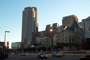
Atlantic Avenue from
State Street
The completion of the Big Dig is evident in this view: the Central Artery, a
major feature of this area, is being dismantled at record pace.
International Place and the Grain and Flour Exchange Building stand
behind the highway structure.

Atlantic Avenue from
State Street: Update
An illustration of the speed at which the Central Artery is being removed,
this shot was taken at the end of the course in May. The Central Waterfront
was the first tour for the course in February.
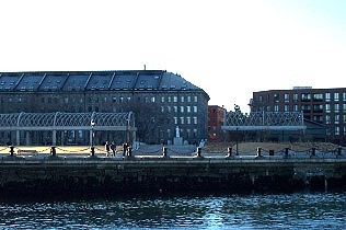
Christopher Columbus Park
The water side promenade of Columbus Park follows the original line of
Atlantic Avenue before it was re-routed in the 1970's to its current path.
Blackstone Block
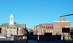
View from Blackstone and
North Streets.
Looking towards the North End from this intersection near the North Market
building, the absence of the Central Artery structure is striking as one can
now clearly see the old Tunnel Administration building on the left and a
portion of the Callahan Tunnel entrance on the right.
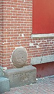
The Boston Stone
The Boston Stone, reputed to be the point from which distances from Boston
are measured (not true!), can be found near Creek Square, which is named for
the site of Mill Creek, which connected the harbor with the Mill Pond.
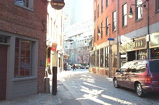
View of Marshall Street
Just off Creek Square is the last remaining Colonial-era section of Boston.
The red sign of the Green Dragon Tavern--reputedly a favored Sons of Liberty
meeting place but not originally sited here--is near the center of this
view, while the Bell in Hand Tavern, the oldest tavern in the U.S., appears
on the right.
Broad Street
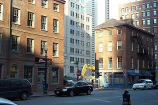
Former Warehouses on
Broad St.
These buildings at #68-70 and 72 Broad St. are some of the remaining
warehouse buildings designed by Bulfinch.
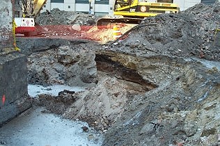
Excavation on Broad St.
This current construction excavation is located on the lot bordered by
Broad, Franklin and Well Streets. On the left is the foundation of the
existing Broad St. building below street grade to give the viewer an idea of
building's depth and the fill area below. The yellow excavator is on
street level.
Dock Square
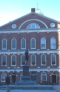
Samuel Adams Statue at
Dock Square
In the 17th century, the site of the Samuel Adams statue and Faneuil Hall
were in the Town Dock. Thus, the area, including that of the camera's
position, was covered by water.
Milk Street
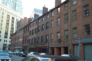
Warehouses on Milk Street
These buildings are the remaining line of wharf warehouse buildings on
Central Wharf, where the New England Aquarium now stands. The Central Artery
cut through some waterfront buildings in the central waterfront area.
State Street
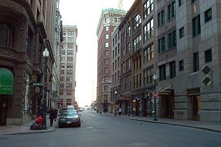
View of State Street
looking towards Long Wharf
State Street, formerly King Street in the 17th and 18th centuries, was the
main street from the waterfront into Boston town. The narrowing of the
street in this view marks the Circular Line--the beginning of Long Wharf .

150 State Street
This building may be an 18th-century Long Wharf building because of its
location on this portion of State Street and its resemblance to pictures of
Long Wharf buildings.
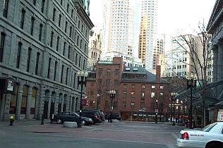
McKinley Square off State
Street
This view of McKinley Square shows the State Street Block on the left, the
entrance of the Custom House on the right, the Central Wharf buildings in
the center, and International Place in the background. Formerly a U.S.
federal building, the Custom House is now a luxury hotel operated by
Marriott.
The Wharves
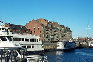
Long Wharf from Central
Wharf
The remaining warehouse cluster stands at the end of Long Wharf opposite the
New England Aquarium. The short building with the gabled roof is the Charter
House.
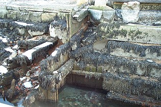
Detail from T Wharf
This view of what appears to be original wharf components was taken on the
north side of T Wharf, near the airport water shuttle embarkation point.
The Long Wharf Marriott Hotel is behind and to the right of this camera
position.
© 2004 Alice Kane